 SAFEEN 3000
Current Status
Where is the vessel?
SAFEEN 3000 is currently in 15 nm SW of Mirfa, based on AIS data received about 20h ago.
Latest AIS update:
Current position: 25.25348° N, 53.33601° E (15 nm SW of Mirfa)
Average speed (last 7 days): Loading…
Average speed (last 30 days): Loading…
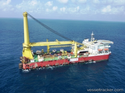
Vessel profile: SAFEEN 3000 is a Pipe-Layer with dimensions 151m x 37m.
This page combines live AIS, route history, probable destination signals, nearby traffic, and port activity for practical vessel monitoring.
The current position of vessel SAFEEN 3000 is 25.25348 lat / 53.33601 lng. Updated: 2026-05-19 18:31:26 UTCNearest reference points:
- Near Das Island
- 21 nm NE of Halul Island
- Near Yas Island
Currently sailing under the flag of Marshall Islands ![]()
SAFEEN 3000 built in 2008 year
Deadweight:
17650 tDetails:
Live Vessel SAFEEN 3000 Analytics (details, animations, etc.)
Recent AIS points (UTC):
2026-05-19 18:31:26 UTC · 25.25348, 53.33601 · SOG 0 kn · COG 315°2026-05-19 18:31:26 UTC · 25.25348, 53.33601 · SOG 0 kn · COG 315°
2026-05-19 18:31:26 UTC · 25.25348, 53.33601 · SOG 0 kn · COG 315°
2026-05-19 18:31:26 UTC · 25.25348, 53.33601 · SOG 0 kn · COG 315°