 vesseltracker.com
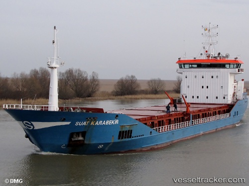
 SUAT KARABEKIR
Current Status
Where is the vessel?
SUAT KARABEKIR is currently in Near ZEYTINBURNU, based on AIS data received less than 1h ago.
Latest AIS update:
Current position: 40.97113° N, 28.92287° E (Near ZEYTINBURNU)
Average speed (last 7 days): Loading…
Average speed (last 30 days): Loading…
Vessel profile: SUAT KARABEKIR is a General Cargo Ship with dimensions 100m x 17m.
This page combines live AIS, route history, probable destination signals, nearby traffic, and port activity for practical vessel monitoring.
The current position of vessel SUAT KARABEKIR is 40.97113 lat / 28.92287 lng. Updated: 2026-05-02 17:40:08 UTCNearest reference points:
- Near ZEYTINBURNU
- Near Davutpasa
- Near BAKIRKOY
Currently sailing under the flag of Panama ![]()
SUAT KARABEKIR built in 2008 year
Deadweight:
7208 tDetails:
Live Vessel SUAT KARABEKIR Analytics (details, animations, etc.)
Recent AIS points (UTC):
2026-05-02 14:25:09 UTC · 40.97133, 28.92242 · SOG 0.2 kn · COG 54°2026-05-02 15:43:07 UTC · 40.97121, 28.92263 · SOG 0 kn · COG 48°
2026-05-02 17:01:06 UTC · 40.97138, 28.92244 · SOG 0.1 kn · COG 56°
2026-05-02 17:40:08 UTC · 40.97113, 28.92287 · SOG 0.3 kn · COG 48°