 vesseltracker.com
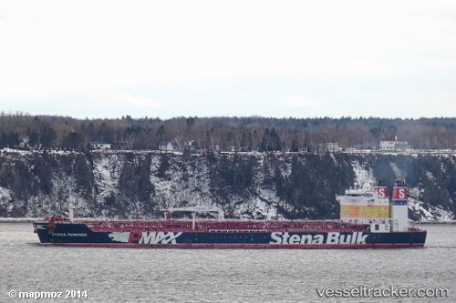
 SHAMAL
Current Status
Where is the vessel?
SHAMAL is currently in 90 nm NE of Braganca, based on AIS data received about 1h ago.
Latest AIS update:
Current position: 0.42046° S, 45.40093° W (90 nm NE of Braganca)
Average speed (last 7 days): Loading…
Average speed (last 30 days): Loading…
Vessel profile: SHAMAL is a Oil Products Tanker with dimensions m x m.
This page combines live AIS, route history, probable destination signals, nearby traffic, and port activity for practical vessel monitoring.
The current position of vessel SHAMAL is -0.42046 lat / -45.40093 lng. Updated: 2026-05-14 16:21:06 UTCNearest reference points:
- 53 nm N of Beija-Flor
- 223 nm SW of Juazeiro-Pi
Currently sailing under the flag of Cyprus ![]()
Details:
Live Vessel SHAMAL Analytics (details, animations, etc.)
Recent AIS points (UTC):
2026-05-14 13:56:26 UTC · -0.34167, -45.92833 · SOG 13 kn · COG -1°2026-05-14 13:59:26 UTC · -0.34333, -45.91667 · SOG 13 kn · COG -1°
2026-05-14 16:21:06 UTC · -0.42046, -45.40093 · SOG 10.3 kn · COG 95°
2026-05-14 16:21:06 UTC · -0.42046, -45.40093 · SOG 10.3 kn · COG 95°