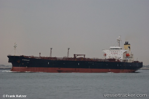
 Emerald
Current Status
Where is the vessel?
Emerald is currently in 29 nm S of Cape St. Francis, based on AIS data received about 14h ago.
Latest AIS update:
Current position: 34.67302° S, 24.80523° E (29 nm S of Cape St. Francis)
Average speed (last 7 days): Loading…
Average speed (last 30 days): Loading…
Vessel profile: Emerald is a Crude Oil Tanker with dimensions 182m x 32m.
This page combines live AIS, route history, probable destination signals, nearby traffic, and port activity for practical vessel monitoring.
The current position of vessel Emerald is -34.67302 lat / 24.80523 lng. Updated: 2026-05-21 03:53:51 UTCNearest reference points:
- 21 nm S of Mount Pleasant
- Near Deal Party
Currently sailing under the flag of Malta ![]()
Emerald built in 2009 year
Deadweight:
47302 tDetails:
Live Vessel Emerald Analytics (details, animations, etc.)
Recent AIS points (UTC):
2026-05-21 00:19:08 UTC · -34.62237, 25.85417 · SOG 17.3 kn · COG 277°2026-05-21 01:02:08 UTC · -34.62880, 25.60785 · SOG 15.4 kn · COG 276°
2026-05-21 02:08:01 UTC · -34.62567, 25.29518 · SOG 13.5 kn · COG 272°
2026-05-21 03:53:51 UTC · -34.67302, 24.80523 · SOG 13.8 kn · COG 265°