 Meloi
Meloi
Current Status
Where is the vessel?
Meloi is currently in 23 nm N of Metis-sur-Mer, based on AIS data received about 15h ago.
Latest AIS update:
Current position: 49.02768° N, 67.80718° W (23 nm N of Metis-sur-Mer)
Average speed (last 7 days): Loading…
Average speed (last 30 days): Loading…
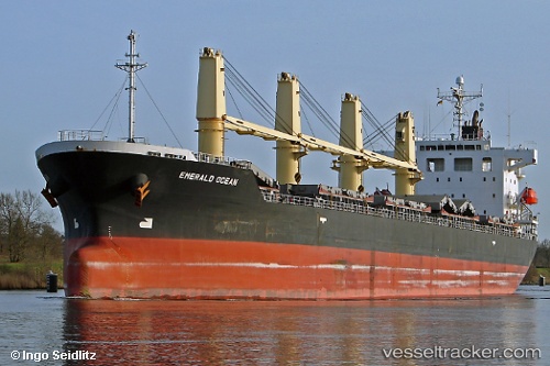
Vessel profile: Meloi is a Bulk Carrier with dimensions 180m x 28m.
This page combines live AIS, route history, probable destination signals, nearby traffic, and port activity for practical vessel monitoring.
The current position of vessel Meloi is 49.02768 lat / -67.80718 lng. Updated: 2026-05-20 07:26:33 UTCNearest reference points:
- 15 nm NW of Saint-Anaclet
- 22 nm N of Sainte-Anne-des-Monts
Currently sailing under the flag of Panama ![]()
Meloi built in 2009 year
Deadweight:
33355 tDetails:
Live Vessel Meloi Analytics (details, animations, etc.)
Recent AIS points (UTC):
2026-05-20 05:04:13 UTC · 49.27625, -67.07873 · SOG 13.3 kn · COG 258°2026-05-20 06:07:34 UTC · 49.17228, -67.40268 · SOG 13.4 kn · COG 246°
2026-05-20 07:17:38 UTC · 49.04493, -67.76091 · SOG 14 kn · COG 240°
2026-05-20 07:26:33 UTC · 49.02768, -67.80718 · SOG 14.1 kn · COG 239°