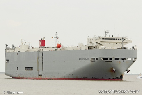
Northern Highway
Current StatusWhere is the vessel?
Northern Highway is currently in 93 nm E of KIJANG, based on AIS data received about 15h ago.
Latest AIS update:
Current position: 0.58253° N, 106.14163° E (93 nm E of KIJANG)
Average speed (last 7 days): Loading…
Average speed (last 30 days): Loading…
Vessel profile: Northern Highway is a Vehicles Carrier with dimensions 28m x 188m.
This page combines live AIS, route history, probable destination signals, nearby traffic, and port activity for practical vessel monitoring.
The current position of vessel Northern Highway is 0.58253 lat / 106.14163 lng. Updated: 2026-05-21 19:20:21 UTCNearest reference points:
- 76 nm NE of KIJANG
- 69 nm NE of Exspan
- 47 nm NE of PENGERANG
Details:
Live Vessel Northern Highway Analytics (details, animations, etc.)
Recent AIS points (UTC):
2026-05-21 15:48:01 UTC · 1.35708, 105.50950 · SOG 17.2 kn · COG 150°2026-05-21 17:45:32 UTC · 0.92262, 105.85265 · SOG 16.9 kn · COG 141°
2026-05-21 19:20:21 UTC · 0.58253, 106.14163 · SOG 16.7 kn · COG 142°
2026-05-21 19:20:21 UTC · 0.58253, 106.14163 · SOG 16.7 kn · COG 142°