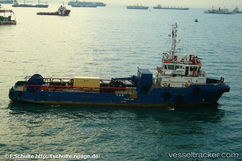
Tanux Iii
Current StatusWhere is the vessel?
Tanux Iii is currently in 21 nm E of Bentley FPSO, based on AIS data received about 14h ago.
Latest AIS update:
Current position: 60.09500° N, 2.32833° E (21 nm E of Bentley FPSO)
Average speed (last 7 days): Loading…
Average speed (last 30 days): Loading…
Vessel profile: Tanux Iii is a Offshore Tug Supply Ship with dimensions 10m x 48m.
This page combines live AIS, route history, probable destination signals, nearby traffic, and port activity for practical vessel monitoring.
The current position of vessel Tanux Iii is 60.09500 lat / 2.32833 lng. Updated: 2026-05-20 15:43:18 UTCNearest reference points:
- 10 nm N of Leadon
- Near Alba Oil Field
Details:
Live Vessel Tanux Iii Analytics (details, animations, etc.)
Recent AIS points (UTC):
2026-05-20 13:01:19 UTC · 60.10833, 2.30667 · SOG 4 kn · COG -1°2026-05-20 13:01:19 UTC · 60.10833, 2.30667 · SOG 4 kn · COG -1°
2026-05-20 15:43:18 UTC · 60.09500, 2.32833 · SOG 5 kn · COG -1°
2026-05-20 15:43:18 UTC · 60.09500, 2.32833 · SOG 5 kn · COG -1°