 SEAJOURNEY
Current Status
Where is the vessel?
SEAJOURNEY is currently in Near KALAMA, based on AIS data received about 14h ago.
Latest AIS update:
Current position: 45.98401° N, 122.83535° W (Near KALAMA)
Average speed (last 7 days): Loading…
Average speed (last 30 days): Loading…
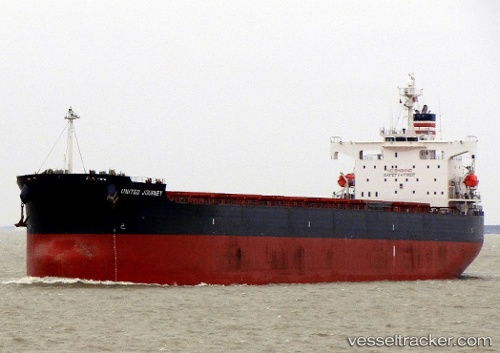
Vessel profile: SEAJOURNEY is a Bulk Carrier with dimensions m x m.
This page combines live AIS, route history, probable destination signals, nearby traffic, and port activity for practical vessel monitoring.
The current position of vessel SEAJOURNEY is 45.98401 lat / -122.83535 lng. Updated: 2026-06-30 21:30:00 UTCNearest reference points:
- Near LONGVIEW
- Near Linnton
- Near Grays River
Currently sailing under the flag of Malta ![]()
Details:
Live Vessel SEAJOURNEY Analytics (details, animations, etc.)
Recent AIS points (UTC):
2026-06-30 18:22:22 UTC · 46.03170, -122.87688 · SOG 6.2 kn · COG 163°2026-06-30 19:16:06 UTC · 45.99178, -122.84332 · SOG 4.8 kn · COG 153°
2026-06-30 19:48:47 UTC · 45.98407, -122.83528 · SOG 0 kn · COG 152°
2026-06-30 21:30:00 UTC · 45.98401, -122.83535 · SOG 0 kn · COG 152°