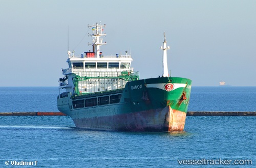
 BARON
BARON
Current Status
Where is the vessel?
BARON is currently in 61 nm NE of PENGERANG, based on AIS data received about 15h ago.
Latest AIS update:
Current position: 2.03484° N, 104.90301° E (61 nm NE of PENGERANG)
Average speed (last 7 days): Loading…
Average speed (last 30 days): Loading…
Vessel profile: BARON is a General Cargo with dimensions m x m.
This page combines live AIS, route history, probable destination signals, nearby traffic, and port activity for practical vessel monitoring.
The current position of vessel BARON is 2.03484 lat / 104.90301 lng. Updated: 2026-05-22 02:27:42 UTCNearest reference points:
- 55 nm NE of PENGERANG
- 53 nm NE of PENGERANG
- 64 nm NE of PENGERANG
Currently sailing under the flag of Marshall Islands ![]()
Details:
Live Vessel BARON Analytics (details, animations, etc.)
Recent AIS points (UTC):
2026-05-21 21:44:47 UTC · 3.18241, 105.29846 · SOG 15.6 kn · COG 203°2026-05-21 23:09:17 UTC · 2.85167, 105.14667 · SOG 15 kn · COG -1°
2026-05-22 01:14:43 UTC · 2.35576, 104.92153 · SOG 15.8 kn · COG 206°
2026-05-22 02:27:42 UTC · 2.03484, 104.90301 · SOG 16 kn · COG 186°