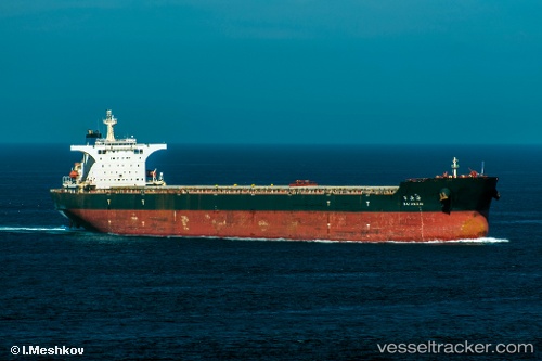
Bai An Hai
Current StatusWhere is the vessel?
Bai An Hai is currently in 18 nm S of Selat Lombok, based on AIS data received about 14h ago.
Latest AIS update:
Current position: 9.12255° S, 115.78432° E (18 nm S of Selat Lombok)
Average speed (last 7 days): Loading…
Average speed (last 30 days): Loading…
Vessel profile: Bai An Hai is a Bulk Carrier with dimensions 45m x 292m.
This page combines live AIS, route history, probable destination signals, nearby traffic, and port activity for practical vessel monitoring.
The current position of vessel Bai An Hai is -9.12255 lat / 115.78432 lng. Updated: 2026-05-22 08:32:35 UTCNearest reference points:
- Near LEMBAR
- Near BENOA
- 29 nm N of MANGGIS
Details:
Live Vessel Bai An Hai Analytics (details, animations, etc.)
Recent AIS points (UTC):
2026-05-22 04:18:17 UTC · -9.78833, 115.92667 · SOG 9 kn · COG -1°2026-05-22 05:21:15 UTC · -9.62333, 115.89167 · SOG 9 kn · COG -1°
2026-05-22 07:43:34 UTC · -9.25156, 115.81104 · SOG 9.8 kn · COG 349°
2026-05-22 08:32:35 UTC · -9.12255, 115.78432 · SOG 10.2 kn · COG 349°