Bermuda
Current StatusWhere is the vessel?
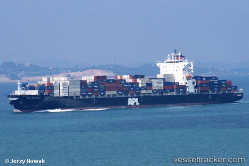
Bermuda is currently in Near Ashdod, based on AIS data received about 14h ago.
Latest AIS update:
Current position: 31.83403° N, 34.64648° E (Near Ashdod)
Average speed (last 7 days): Loading…
Average speed (last 30 days): Loading…
Vessel profile: Bermuda is a Container Ship with dimensions 32m x 259m.
This page combines live AIS, route history, probable destination signals, nearby traffic, and port activity for practical vessel monitoring.
The current position of vessel Bermuda is 31.83403 lat / 34.64648 lng. Updated: 2026-05-21 03:52:47 UTCNearest reference points:
- Near Haifa
- Near AL ARISH
- 22 nm W of Haifa Granaries
Details:
Live Vessel Bermuda Analytics (details, animations, etc.)
Recent AIS points (UTC):
2026-05-21 00:16:45 UTC · 31.83406, 34.64640 · SOG 0 kn · COG 270°2026-05-21 01:01:49 UTC · 31.83406, 34.64647 · SOG 0 kn · COG 269°
2026-05-21 02:01:46 UTC · 31.83408, 34.64639 · SOG 0 kn · COG 269°
2026-05-21 03:52:47 UTC · 31.83403, 34.64648 · SOG 0 kn · COG 269°