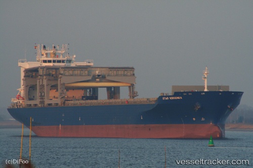
 Star Kirkenes
Current Status
Where is the vessel?
Star Kirkenes is currently in 20 nm W of Sukumowan, based on AIS data received about 14h ago.
Latest AIS update:
Current position: 32.91798° N, 132.31116° E (20 nm W of Sukumowan)
Average speed (last 7 days): Loading…
Average speed (last 30 days): Loading…
Vessel profile: Star Kirkenes is a Multi Purpose Carrier with dimensions 208m x 32m.
This page combines live AIS, route history, probable destination signals, nearby traffic, and port activity for practical vessel monitoring.
The current position of vessel Star Kirkenes is 32.91798 lat / 132.31116 lng. Updated: 2026-05-21 07:13:09 UTCNearest reference points:
- 19 nm SW of Sukumowan
- 11 nm E of SAEKI
- Near Kitsuki
Currently sailing under the flag of Norway ![]()
Star Kirkenes built in 2009 year
Deadweight:
49924 tDetails:
Live Vessel Star Kirkenes Analytics (details, animations, etc.)
Recent AIS points (UTC):
2026-05-21 03:39:00 UTC · 33.60041, 131.80560 · SOG 14.5 kn · COG 146°2026-05-21 04:01:25 UTC · 33.51846, 131.85251 · SOG 14.4 kn · COG 158°
2026-05-21 05:39:16 UTC · 33.20167, 132.06833 · SOG 14 kn · COG -1°
2026-05-21 07:13:09 UTC · 32.91798, 132.31116 · SOG 13.4 kn · COG 155°