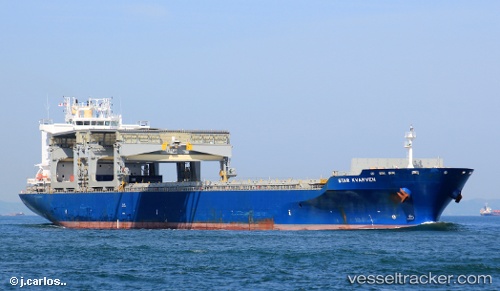
Star Kvarven
Current StatusWhere is the vessel?
Star Kvarven is currently in 44 nm SW of Tatoosh Island, based on AIS data received about 14h ago.
Latest AIS update:
Current position: 47.94446° N, 125.62484° W (44 nm SW of Tatoosh Island)
Average speed (last 7 days): Loading…
Average speed (last 30 days): Loading…
Vessel profile: Star Kvarven is a Multi Purpose Carrier with dimensions 32m x 208m.
This page combines live AIS, route history, probable destination signals, nearby traffic, and port activity for practical vessel monitoring.
The current position of vessel Star Kvarven is 47.94446 lat / -125.62484 lng. Updated: 2026-05-19 03:24:59 UTCNearest reference points:
- 21 nm NW of Tatoosh Island
- Near Clallam Bay
- Near Grays Harbor City
Details:
Live Vessel Star Kvarven Analytics (details, animations, etc.)
Recent AIS points (UTC):
2026-05-19 00:07:33 UTC · 47.58079, -126.13931 · SOG 9.2 kn · COG 40°2026-05-19 01:54:59 UTC · 47.78667, -125.87167 · SOG 9 kn · COG -1°
2026-05-19 02:32:29 UTC · 47.85345, -125.77388 · SOG 9.3 kn · COG 41°
2026-05-19 03:24:59 UTC · 47.94446, -125.62484 · SOG 8.9 kn · COG 39°