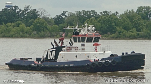
 Gasparilla
Current Status
Where is the vessel?
Gasparilla is currently in Near Tampa, based on AIS data received about 14h ago.
Latest AIS update:
Current position: 27.92259° N, 82.44632° W (Near Tampa)
Average speed (last 7 days): Loading…
Average speed (last 30 days): Loading…
Vessel profile: Gasparilla is a Tug with dimensions 32m x 12m.
This page combines live AIS, route history, probable destination signals, nearby traffic, and port activity for practical vessel monitoring.
The current position of vessel Gasparilla is 27.92259 lat / -82.44632 lng. Updated: 2026-07-07 01:31:31 UTCNearest reference points:
- Near Tampa
- Near St. Petersburg
- Near Saint Petersburg
Currently sailing under the flag of USA ![]()
Details:
Live Vessel Gasparilla Analytics (details, animations, etc.)
Recent AIS points (UTC):
2026-07-06 21:59:41 UTC · 27.92260, -82.44634 · SOG 0 kn · COG 46°2026-07-06 22:35:11 UTC · 27.92259, -82.44632 · SOG 0 kn · COG 46°
2026-07-07 00:10:12 UTC · 27.92259, -82.44634 · SOG 0 kn · COG 46°
2026-07-07 01:31:31 UTC · 27.92259, -82.44632 · SOG 0 kn · COG 47°