 HONG DENG
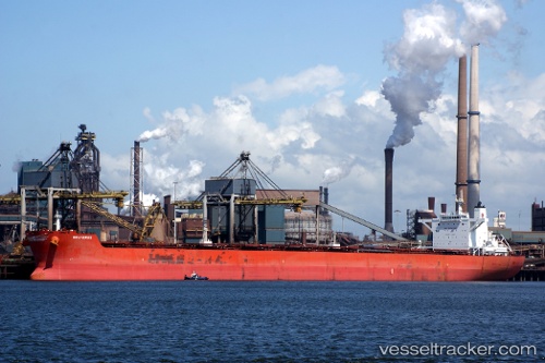
Current Status
Where is the vessel?
HONG DENG is currently in Near San Nicolas, based on AIS data received about 14h ago.
Latest AIS update:
Current position: 15.19815° S, 75.26547° W (Near San Nicolas)
Average speed (last 7 days): Loading…
Average speed (last 30 days): Loading…
Vessel profile: HONG DENG is a Bulk Carrier with dimensions m x m.
This page combines live AIS, route history, probable destination signals, nearby traffic, and port activity for practical vessel monitoring.
The current position of vessel HONG DENG is -15.19815 lat / -75.26547 lng. Updated: 2026-07-08 04:05:40 UTCNearest reference points:
- 110 nm SW of San Juan
Currently sailing under the flag of Panama ![]()
Details:
Live Vessel HONG DENG Analytics (details, animations, etc.)
Recent AIS points (UTC):
2026-07-08 00:17:40 UTC · -15.19804, -75.26572 · SOG 0.2 kn · COG 179°2026-07-08 00:53:38 UTC · -15.19812, -75.26548 · SOG 0.1 kn · COG 184°
2026-07-08 02:05:36 UTC · -15.19818, -75.26532 · SOG 0.1 kn · COG 190°
2026-07-08 04:05:40 UTC · -15.19815, -75.26547 · SOG 0.2 kn · COG 186°