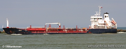
 RIO FYN
Current Status
Where is the vessel?
RIO FYN is currently in 17 nm NE of Puerto De Hierro, based on AIS data received about 14h ago.
Latest AIS update:
Current position: 10.83604° N, 61.89673° W (17 nm NE of Puerto De Hierro)
Average speed (last 7 days): Loading…
Average speed (last 30 days): Loading…
Vessel profile: RIO FYN is a Oil/Chemical Tanker with dimensions m x m.
This page combines live AIS, route history, probable destination signals, nearby traffic, and port activity for practical vessel monitoring.
The current position of vessel RIO FYN is 10.83604 lat / -61.89673 lng. Updated: 2026-07-01 11:44:24 UTCNearest reference points:
- Near CARENAGE
- Near Carenage
- Near Caroni
Currently sailing under the flag of Portugal ![]()
Details:
Live Vessel RIO FYN Analytics (details, animations, etc.)
Recent AIS points (UTC):
2026-07-01 08:01:28 UTC · 11.20902, -62.40585 · SOG 9.4 kn · COG 124°2026-07-01 09:33:34 UTC · 11.06425, -62.20426 · SOG 9.8 kn · COG 120°
2026-07-01 10:42:46 UTC · 10.94721, -62.04276 · SOG 10.4 kn · COG 128°
2026-07-01 11:44:24 UTC · 10.83604, -61.89673 · SOG 10 kn · COG 129°