 St. Gertrud
Current Status
Where is the vessel?
St. Gertrud is currently in 35 nm NW of Latchi, based on AIS data received about 14h ago.
Latest AIS update:
Current position: 35.61328° N, 32.13123° E (35 nm NW of Latchi)
Average speed (last 7 days): Loading…
Average speed (last 30 days): Loading…
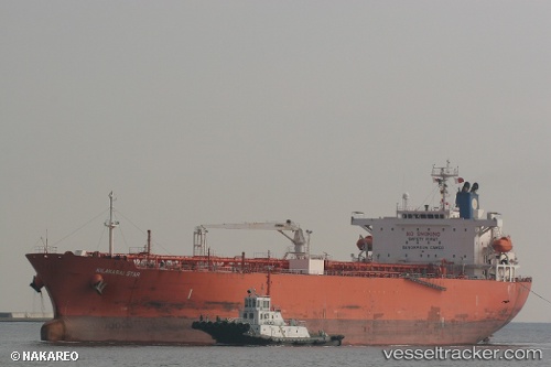
Vessel profile: St. Gertrud is a Oil Products Tanker with dimensions 180m x 32m.
This page combines live AIS, route history, probable destination signals, nearby traffic, and port activity for practical vessel monitoring.
The current position of vessel St. Gertrud is 35.61328 lat / 32.13123 lng. Updated: 2026-07-05 03:26:04 UTCNearest reference points:
- 11 nm SE of Paphos
- 20 nm SW of Yesilovacik
- Near Limassol
Currently sailing under the flag of Panama ![]()
St. Gertrud built in 2009 year
Deadweight:
46622 tDetails:
Live Vessel St. Gertrud Analytics (details, animations, etc.)
Recent AIS points (UTC):
2026-07-05 00:18:23 UTC · 35.57935, 32.12230 · SOG 0.5 kn · COG 166°2026-07-05 02:13:54 UTC · 35.59892, 32.12700 · SOG 0.7 kn · COG 159°
2026-07-05 02:31:23 UTC · 35.60235, 32.12812 · SOG 0.6 kn · COG 157°
2026-07-05 03:26:04 UTC · 35.61328, 32.13123 · SOG 0.8 kn · COG 171°