 BOSPHORUS S
Current Status
Where is the vessel?
BOSPHORUS S is currently in 51 nm NW of ABU QIR, based on AIS data received about 15h ago.
Latest AIS update:
Current position: 32.02080° N, 29.53762° E (51 nm NW of ABU QIR)
Average speed (last 7 days): Loading…
Average speed (last 30 days): Loading…
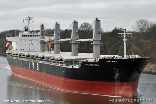
Vessel profile: BOSPHORUS S is a General Cargo with dimensions m x m.
This page combines live AIS, route history, probable destination signals, nearby traffic, and port activity for practical vessel monitoring.
The current position of vessel BOSPHORUS S is 32.02080 lat / 29.53762 lng. Updated: 2026-05-21 04:36:17 UTCNearest reference points:
- 28 nm N of Hamra
- Near EL DEKHEILA
- 13 nm W of EL DEKHEILA
Currently sailing under the flag of Liberia ![]()
Details:
Live Vessel BOSPHORUS S Analytics (details, animations, etc.)
Recent AIS points (UTC):
2026-05-21 01:59:50 UTC · 32.44333, 29.30333 · SOG 10 kn · COG -1°2026-05-21 02:50:47 UTC · 32.30667, 29.38167 · SOG 10 kn · COG -1°
2026-05-21 04:35:37 UTC · 32.02268, 29.53657 · SOG 11 kn · COG 159°
2026-05-21 04:36:17 UTC · 32.02080, 29.53762 · SOG 10.9 kn · COG 160°