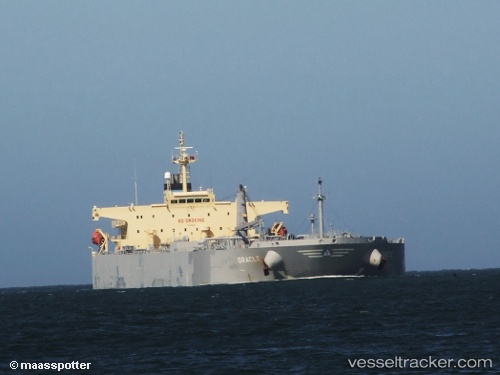
 EVALI
EVALI
Current Status
Where is the vessel?
EVALI is currently in 17 nm E of Dalian, based on AIS data received about 14h ago.
Latest AIS update:
Current position: 38.93233° N, 122.01510° E (17 nm E of Dalian)
Average speed (last 7 days): Loading…
Average speed (last 30 days): Loading…
Vessel profile: EVALI is a Crude Oil Tanker with dimensions m x m.
This page combines live AIS, route history, probable destination signals, nearby traffic, and port activity for practical vessel monitoring.
The current position of vessel EVALI is 38.93233 lat / 122.01510 lng. Updated: 2026-05-19 13:02:38 UTCNearest reference points:
- 15 nm E of Dalian
- 20 nm E of Dalian
- 15 nm SE of Dalian
Currently sailing under the flag of Comoros ![]()
Details:
Live Vessel EVALI Analytics (details, animations, etc.)
Recent AIS points (UTC):
2026-05-19 09:35:40 UTC · 38.93232, 122.01647 · SOG 0.1 kn · COG 190°2026-05-19 11:14:38 UTC · 38.93220, 122.01688 · SOG 0 kn · COG 196°
2026-05-19 11:26:38 UTC · 38.93215, 122.01697 · SOG 0 kn · COG 198°
2026-05-19 13:02:38 UTC · 38.93233, 122.01510 · SOG 0.1 kn · COG 160°