 vesseltracker.com
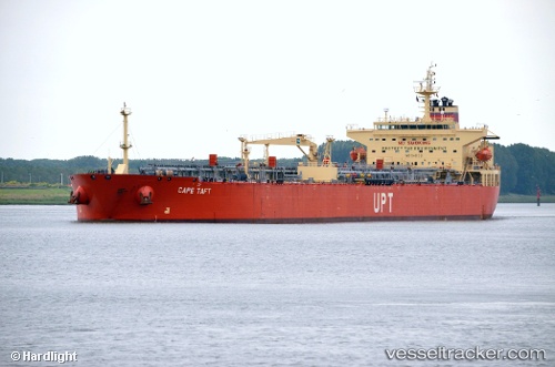
Cape Taft
Current StatusWhere is the vessel?
Cape Taft is currently in Near Sheppard, based on AIS data received about 16h ago.
Latest AIS update:
Current position: 29.18905° N, 94.67228° W (Near Sheppard)
Average speed (last 7 days): Loading…
Average speed (last 30 days): Loading…
Vessel profile: Cape Taft is a Crude Oil Tanker with dimensions 32m x 228m.
This page combines live AIS, route history, probable destination signals, nearby traffic, and port activity for practical vessel monitoring.
The current position of vessel Cape Taft is 29.18905 lat / -94.67228 lng. Updated: 2026-05-18 07:51:54 UTCNearest reference points:
- 12 nm SE of Port Bolivar
- Near Port Bolivar
- Near Texas City
Details:
Live Vessel Cape Taft Analytics (details, animations, etc.)
Recent AIS points (UTC):
2026-05-18 04:51:46 UTC · 29.18855, -94.67260 · SOG 0.2 kn · COG 106°2026-05-18 05:30:46 UTC · 29.18864, -94.67256 · SOG 0.2 kn · COG 108°
2026-05-18 07:24:49 UTC · 29.18888, -94.67243 · SOG 0.2 kn · COG 115°
2026-05-18 07:51:54 UTC · 29.18905, -94.67228 · SOG 0.1 kn · COG 123°