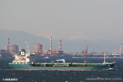
Alinya
Current StatusWhere is the vessel?
Alinya is currently in Near Zhangjiagang, based on AIS data received about 14h ago.
Latest AIS update:
Current position: 31.98009° N, 120.45001° E (Near Zhangjiagang)
Average speed (last 7 days): Loading…
Average speed (last 30 days): Loading…
Vessel profile: Alinya is a Chemical Oil Products Tanker with dimensions 20m x 128m.
This page combines live AIS, route history, probable destination signals, nearby traffic, and port activity for practical vessel monitoring.
The current position of vessel Alinya is 31.98009 lat / 120.45001 lng. Updated: 2026-05-20 22:33:33 UTCNearest reference points:
- Near Zhangjiagang
- Near Jingjiang Pt
- Near Jiangyin Pt
Details:
Live Vessel Alinya Analytics (details, animations, etc.)
Recent AIS points (UTC):
2026-05-20 18:03:36 UTC · 31.98007, 120.45004 · SOG 0 kn · COG 220°2026-05-20 18:09:37 UTC · 31.98006, 120.45002 · SOG 0 kn · COG 220°
2026-05-20 21:12:38 UTC · 31.98005, 120.45004 · SOG 0 kn · COG 220°
2026-05-20 22:33:33 UTC · 31.98009, 120.45001 · SOG 0 kn · COG 220°