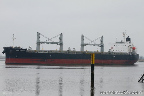
Tawa Arrow
Current StatusWhere is the vessel?
Tawa Arrow is currently in Near Livorno, based on AIS data received about 14h ago.
Latest AIS update:
Current position: 43.55568° N, 10.29840° E (Near Livorno)
Average speed (last 7 days): Loading…
Average speed (last 30 days): Loading…
Vessel profile: Tawa Arrow is a General Cargo Ship with dimensions 32m x 190m.
This page combines live AIS, route history, probable destination signals, nearby traffic, and port activity for practical vessel monitoring.
The current position of vessel Tawa Arrow is 43.55568 lat / 10.29840 lng. Updated: 2026-05-19 19:33:13 UTCNearest reference points:
- Near Livorno
- Near Guasticce
- Near Marina di Pisa
Details:
Live Vessel Tawa Arrow Analytics (details, animations, etc.)
Recent AIS points (UTC):
2026-05-19 16:18:14 UTC · 43.55567, 10.29838 · SOG 0.1 kn · COG 45°2026-05-19 17:24:15 UTC · 43.55566, 10.29832 · SOG 0.1 kn · COG 45°
2026-05-19 19:30:14 UTC · 43.55568, 10.29840 · SOG 0 kn · COG 45°
2026-05-19 19:33:13 UTC · 43.55568, 10.29840 · SOG 0 kn · COG 45°