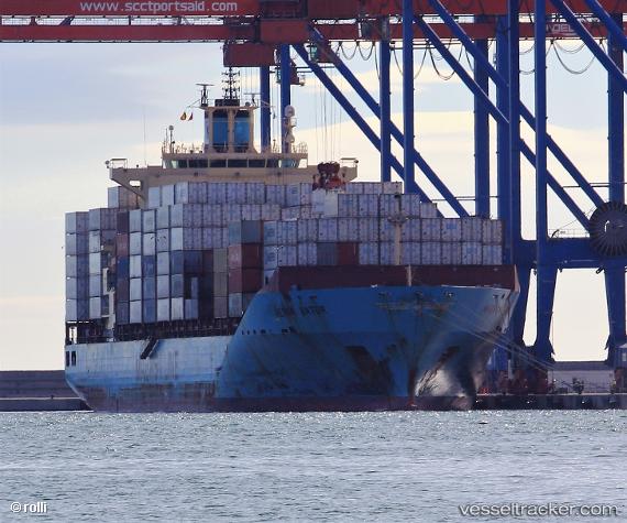
 Maersk Batur
Current Status
Where is the vessel?
Maersk Batur is currently in 56 nm S of Boboras, based on AIS data received about 14h ago.
Latest AIS update:
Current position: 45.52167° N, 8.44500° W (56 nm S of Boboras)
Average speed (last 7 days): Loading…
Average speed (last 30 days): Loading…
Vessel profile: Maersk Batur is a Container Ship with dimensions 223m x 32m.
This page combines live AIS, route history, probable destination signals, nearby traffic, and port activity for practical vessel monitoring.
The current position of vessel Maersk Batur is 45.52167 lat / -8.44500 lng. Updated: 2026-05-20 01:47:35 UTCNearest reference points:
- 57 nm S of Boboras
- 22 nm N of Carino
- 30 nm NW of Meiras-Valdoviño
Currently sailing under the flag of Singapore ![]()
Maersk Batur built in 2009 year
Deadweight:
43273 tDetails:
Live Vessel Maersk Batur Analytics (details, animations, etc.)
Recent AIS points (UTC):
2026-05-19 23:05:32 UTC · 46.00500, -8.06500 · SOG 12 kn · COG -1°2026-05-20 00:08:34 UTC · 45.81333, -8.20833 · SOG 12 kn · COG -1°
2026-05-20 01:11:32 UTC · 45.62667, -8.35167 · SOG 12 kn · COG -1°
2026-05-20 01:47:35 UTC · 45.52167, -8.44500 · SOG 12 kn · COG -1°