 RUBAIYAT HANIF
Current Status
Where is the vessel?
RUBAIYAT HANIF is currently in 12 nm S of HAMBANTOTA, based on AIS data received about 15h ago.
Latest AIS update:
Current position: 5.93297° N, 81.07543° E (12 nm S of HAMBANTOTA)
Average speed (last 7 days): Loading…
Average speed (last 30 days): Loading…
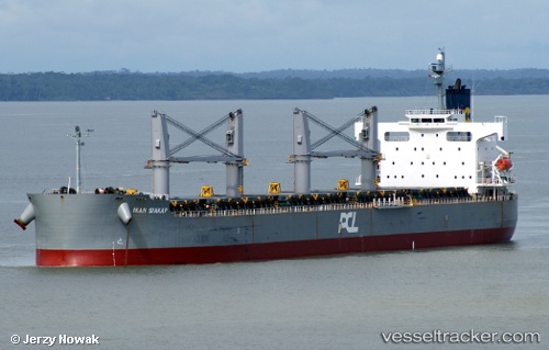
Vessel profile: RUBAIYAT HANIF is a Bulk Carrier with dimensions 32m x 185m.
This page combines live AIS, route history, probable destination signals, nearby traffic, and port activity for practical vessel monitoring.
The current position of vessel RUBAIYAT HANIF is 5.93297 lat / 81.07543 lng. Updated: 2026-07-07 00:20:21 UTCNearest reference points:
- Near HAMBANTOTA
- 15 nm S of Koggala
- 28 nm SW of Matara
Currently sailing under the flag of Bangladesh ![]()
RUBAIYAT HANIF built in 2008 year
Deadweight:
58713 tDetails:
Live Vessel RUBAIYAT HANIF Analytics (details, animations, etc.)
Recent AIS points (UTC):
2026-07-06 21:47:21 UTC · 5.98457, 81.09689 · SOG 7 kn · COG 160°2026-07-06 23:17:32 UTC · 5.93349, 81.08256 · SOG 0.8 kn · COG 294°
2026-07-07 00:15:01 UTC · 5.93314, 81.07622 · SOG 0.5 kn · COG 287°
2026-07-07 00:20:21 UTC · 5.93297, 81.07543 · SOG 0.9 kn · COG 291°