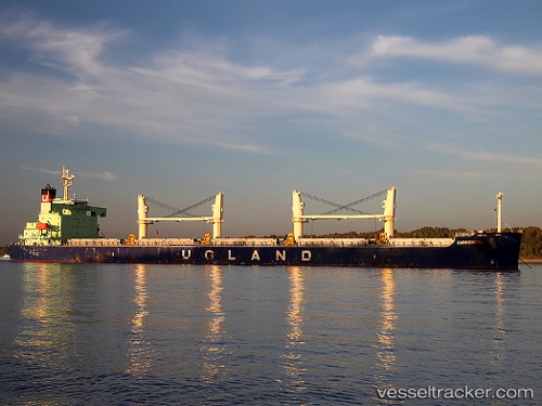
Carmencita
Current StatusWhere is the vessel?
Carmencita is currently in 162 nm SW of Nayarit, based on AIS data received about 15h ago.
Latest AIS update:
Current position: 20.28667° N, 109.01833° W (162 nm SW of Nayarit)
Average speed (last 7 days): Loading…
Average speed (last 30 days): Loading…
Vessel profile: Carmencita is a Bulk Carrier with dimensions 32m x 185m.
This page combines live AIS, route history, probable destination signals, nearby traffic, and port activity for practical vessel monitoring.
The current position of vessel Carmencita is 20.28667 lat / -109.01833 lng. Updated: 2026-05-29 07:52:01 UTCNearest reference points:
- 67 nm S of Los Cabos
- 35 nm S of Nayarit
Details:
Live Vessel Carmencita Analytics (details, animations, etc.)
Recent AIS points (UTC):
2026-05-29 04:44:53 UTC · 20.56313, -109.64087 · SOG 12.3 kn · COG 116°2026-05-29 06:10:44 UTC · 20.43647, -109.35708 · SOG 12.4 kn · COG 115°
2026-05-29 07:42:54 UTC · 20.30056, -109.04989 · SOG 12.4 kn · COG 114°
2026-05-29 07:52:01 UTC · 20.28667, -109.01833 · SOG 12 kn · COG -1°