Kariyushi Leader
Current StatusWhere is the vessel?
Kariyushi Leader is currently in 20 nm W of Tanjong Bin, based on AIS data received about 14h ago.
Latest AIS update:
Current position: 1.41344° N, 103.23238° E (20 nm W of Tanjong Bin)
Average speed (last 7 days): Loading…
Average speed (last 30 days): Loading…
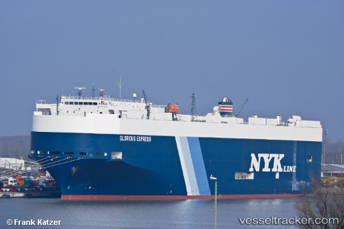
Vessel profile: Kariyushi Leader is a Vehicles Carrier with dimensions 32m x 180m.
This page combines live AIS, route history, probable destination signals, nearby traffic, and port activity for practical vessel monitoring.
The current position of vessel Kariyushi Leader is 1.41344 lat / 103.23238 lng. Updated: 2026-05-22 10:24:50 UTCNearest reference points:
- 19 nm W of Tanjong Bin
- 15 nm W of Tanjong Bin
- 17 nm NE of Perawang
Details:
Live Vessel Kariyushi Leader Analytics (details, animations, etc.)
Recent AIS points (UTC):
2026-05-22 07:42:14 UTC · 1.17207, 103.79639 · SOG 14.1 kn · COG 246°2026-05-22 08:29:26 UTC · 1.19165, 103.62275 · SOG 15.1 kn · COG 285°
2026-05-22 10:13:20 UTC · 1.38375, 103.26279 · SOG 15.3 kn · COG 314°
2026-05-22 10:24:50 UTC · 1.41344, 103.23238 · SOG 15.3 kn · COG -1°