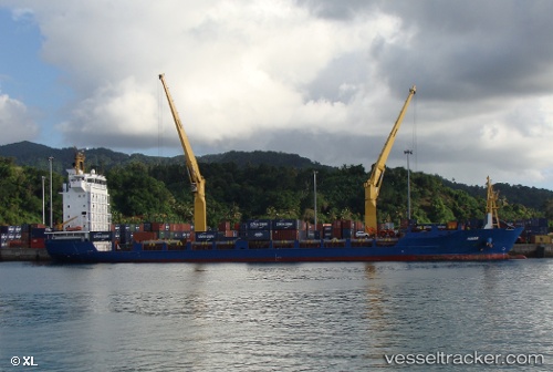
 Kiara
Kiara
Current Status
Where is the vessel?
Kiara is currently in 46 nm NE of Saint-André, based on AIS data received about 14h ago.
Latest AIS update:
Current position: 20.47200° S, 56.29579° E (46 nm NE of Saint-André)
Average speed (last 7 days): Loading…
Average speed (last 30 days): Loading…
Vessel profile: Kiara is a Multi Purpose Carrier with dimensions 123m x 21m.
This page combines live AIS, route history, probable destination signals, nearby traffic, and port activity for practical vessel monitoring.
The current position of vessel Kiara is -20.47200 lat / 56.29579 lng. Updated: 2026-05-22 10:04:35 UTCNearest reference points:
- Near Port Louis
- 164 nm NW of Pointe aux Canonniers
Currently sailing under the flag of Antigua Barbuda ![]()
Details:
Live Vessel Kiara Analytics (details, animations, etc.)
Recent AIS points (UTC):
2026-05-22 06:00:36 UTC · -20.72432, 55.52609 · SOG 11.5 kn · COG 73°2026-05-22 07:37:16 UTC · -20.62602, 55.82660 · SOG 11.1 kn · COG 71°
2026-05-22 07:53:05 UTC · -20.60995, 55.87567 · SOG 11.2 kn · COG 71°
2026-05-22 10:04:35 UTC · -20.47200, 56.29579 · SOG 11.1 kn · COG 72°