 vesseltracker.com
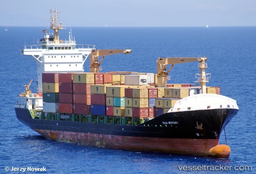
 DOUALA EXPRESS
Current Status
Where is the vessel?
DOUALA EXPRESS is currently in 19 nm W of SOYO, based on AIS data received about 1h ago.
Latest AIS update:
Current position: 6.01088° S, 12.03262° E (19 nm W of SOYO)
Average speed (last 7 days): Loading…
Average speed (last 30 days): Loading…
Vessel profile: DOUALA EXPRESS is a Container Ship with dimensions 148m x 23m.
This page combines live AIS, route history, probable destination signals, nearby traffic, and port activity for practical vessel monitoring.
The current position of vessel DOUALA EXPRESS is -6.01088 lat / 12.03262 lng. Updated: 2026-05-15 17:52:43 UTCNearest reference points:
- Near SOYO
- 11 nm W of Cabinda
- Near Futila Terminal
Currently sailing under the flag of Liberia ![]()
DOUALA EXPRESS built in 2009 year
Deadweight:
13702 tDetails:
Live Vessel DOUALA EXPRESS Analytics (details, animations, etc.)
Recent AIS points (UTC):
2026-05-15 13:30:29 UTC · -5.99710, 12.85445 · SOG 13.5 kn · COG 335°2026-05-15 15:34:04 UTC · -6.04742, 12.41888 · SOG 4.2 kn · COG 269°
2026-05-15 16:40:43 UTC · -6.04305, 12.24284 · SOG 10.4 kn · COG 266°
2026-05-15 17:52:43 UTC · -6.01088, 12.03262 · SOG 10.7 kn · COG 280°