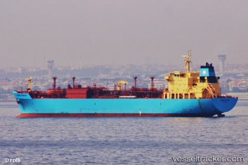
 Navigator Virgo
Current Status
Where is the vessel?
Navigator Virgo is currently in 50 nm N of Arzew, based on AIS data received about 14h ago.
Latest AIS update:
Current position: 36.67438° N, 0.48467° W (50 nm N of Arzew)
Average speed (last 7 days): Loading…
Average speed (last 30 days): Loading…
Vessel profile: Navigator Virgo is a Lpg Tanker with dimensions 160m x 33m.
This page combines live AIS, route history, probable destination signals, nearby traffic, and port activity for practical vessel monitoring.
The current position of vessel Navigator Virgo is 36.67438 lat / -0.48467 lng. Updated: 2026-05-20 16:06:27 UTCNearest reference points:
- 49 nm S of Rejected
- 43 nm NW of Mostaganem
- 50 nm N of Mostaganem
Currently sailing under the flag of Liberia ![]()
Navigator Virgo built in 2009 year
Deadweight:
23273 tDetails:
Live Vessel Navigator Virgo Analytics (details, animations, etc.)
Recent AIS points (UTC):
2026-05-20 11:39:26 UTC · 36.48082, -1.59962 · SOG 12.2 kn · COG 82°2026-05-20 13:22:38 UTC · 36.54300, -1.16638 · SOG 12 kn · COG 75°
2026-05-20 13:39:27 UTC · 36.55582, -1.09565 · SOG 12.2 kn · COG 75°
2026-05-20 16:06:27 UTC · 36.67438, -0.48467 · SOG 12.5 kn · COG 98°