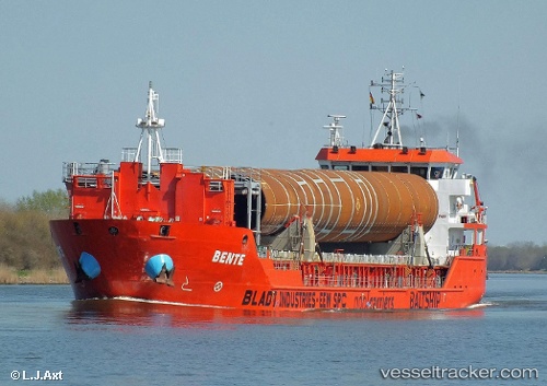
 Bente
Bente
Current Status
Where is the vessel?
Bente is currently in Near Domburg, based on AIS data received about 14h ago.
Latest AIS update:
Current position: 51.59539° N, 3.38923° E (Near Domburg)
Average speed (last 7 days): Loading…
Average speed (last 30 days): Loading…
Vessel profile: Bente is a General Cargo Ship with dimensions 90m x 14m.
This page combines live AIS, route history, probable destination signals, nearby traffic, and port activity for practical vessel monitoring.
The current position of vessel Bente is 51.59539 lat / 3.38923 lng. Updated: 2026-06-12 13:33:18 UTCNearest reference points:
- Near Hunsdon
- Near BRESKENS
- Near Flushing
Currently sailing under the flag of Netherlands ![]()
Bente built in 2008 year
Deadweight:
4000 tDetails:
Live Vessel Bente Analytics (details, animations, etc.)
Recent AIS points (UTC):
2026-06-12 09:36:19 UTC · 51.38594, 3.76568 · SOG 0 kn · COG 292°2026-06-12 10:32:28 UTC · 51.38592, 3.76570 · SOG 0 kn · COG 292°
2026-06-12 12:25:07 UTC · 51.43695, 3.61609 · SOG 11.7 kn · COG 262°
2026-06-12 13:33:18 UTC · 51.59539, 3.38923 · SOG 11.6 kn · COG 316°