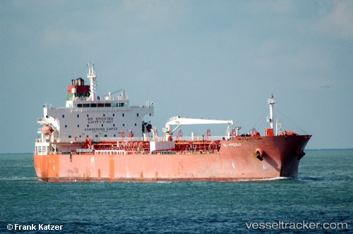
Al Amerat
Current StatusWhere is the vessel?
Al Amerat is currently in Near Dumai, based on AIS data received about 14h ago.
Latest AIS update:
Current position: 1.75958° N, 101.36643° E (Near Dumai)
Average speed (last 7 days): Loading…
Average speed (last 30 days): Loading…
Vessel profile: Al Amerat is a Chemical Oil Products Tanker with dimensions 32m x 183m.
This page combines live AIS, route history, probable destination signals, nearby traffic, and port activity for practical vessel monitoring.
The current position of vessel Al Amerat is 1.75958 lat / 101.36643 lng. Updated: 2026-05-23 18:07:04 UTCNearest reference points:
- Near Dumai
- 14 nm W of SUNGAI UDANG
- 13 nm SW of PORT DICKSON
Details:
Live Vessel Al Amerat Analytics (details, animations, etc.)
Recent AIS points (UTC):
2026-05-23 13:11:15 UTC · 1.75955, 101.36637 · SOG 0 kn · COG -1°2026-05-23 13:11:15 UTC · 1.75955, 101.36637 · SOG 0 kn · COG -1°
2026-05-23 16:06:44 UTC · 1.75977, 101.36597 · SOG 0.1 kn · COG -1°
2026-05-23 18:07:04 UTC · 1.75958, 101.36643 · SOG 0 kn · COG -1°