 vesseltracker.com
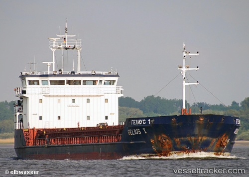
 GELMOND 1
Current Status
Where is the vessel?
GELMOND 1 is currently in Near TUZLA, based on AIS data received less than 1h ago.
Latest AIS update:
Current position: 40.84992° N, 29.28836° E (Near TUZLA)
Average speed (last 7 days): Loading…
Average speed (last 30 days): Loading…
Vessel profile: GELMOND 1 is a General Cargo with dimensions 115.2m x 16m.
This page combines live AIS, route history, probable destination signals, nearby traffic, and port activity for practical vessel monitoring.
The current position of vessel GELMOND 1 is 40.84992 lat / 29.28836 lng. Updated: 2026-05-15 11:37:56 UTCNearest reference points:
- Near TUZLA
- Near Tuzla Free Zone
- Near PENDIK
Currently sailing under the flag of St Kitts Nevis ![]()
GELMOND 1 built in 2007 year
Deadweight:
3510 tDetails:
Live Vessel GELMOND 1 Analytics (details, animations, etc.)
Recent AIS points (UTC):
2026-05-15 07:49:57 UTC · 40.84991, 29.28839 · SOG 0 kn · COG 73°2026-05-15 09:37:57 UTC · 40.84994, 29.28840 · SOG 0 kn · COG 73°
2026-05-15 10:28:59 UTC · 40.84994, 29.28839 · SOG 0 kn · COG 73°
2026-05-15 11:37:56 UTC · 40.84992, 29.28836 · SOG 0 kn · COG 73°