 NOUR MUSHTOFA
Current Status
Where is the vessel?
NOUR MUSHTOFA is currently in Near CIWANDAN, based on AIS data received about 14h ago.
Latest AIS update:
Current position: 5.98906° S, 105.92534° E (Near CIWANDAN)
Average speed (last 7 days): Loading…
Average speed (last 30 days): Loading…
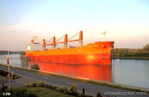
Vessel profile: NOUR MUSHTOFA is a Bulk Carrier with dimensions m x m.
This page combines live AIS, route history, probable destination signals, nearby traffic, and port activity for practical vessel monitoring.
The current position of vessel NOUR MUSHTOFA is -5.98906 lat / 105.92534 lng. Updated: 2026-05-20 22:23:22 UTCNearest reference points:
- Near Cigading
- Near CIWANDAN
- Near MERAK
Currently sailing under the flag of Indonesia ![]()
Details:
Live Vessel NOUR MUSHTOFA Analytics (details, animations, etc.)
Recent AIS points (UTC):
2026-05-20 17:41:20 UTC · -5.98607, 105.92563 · SOG 0.2 kn · COG 96°2026-05-20 19:13:18 UTC · -5.98667, 105.92500 · SOG 0 kn · COG -1°
2026-05-20 22:02:16 UTC · -5.98831, 105.92481 · SOG 0 kn · COG 36°
2026-05-20 22:23:22 UTC · -5.98906, 105.92534 · SOG 0.1 kn · COG 29°