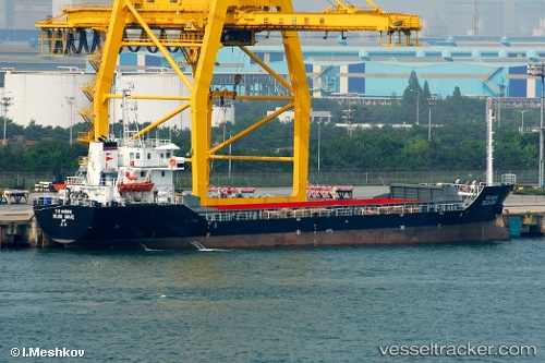
 DOJUN BRAVE
Current Status
Where is the vessel?
DOJUN BRAVE is currently in 11 nm NE of IKA JZ, based on AIS data received about 15h ago.
Latest AIS update:
Current position: 44.41134° N, 13.76488° E (11 nm NE of IKA JZ)
Average speed (last 7 days): Loading…
Average speed (last 30 days): Loading…
Vessel profile: DOJUN BRAVE is a General Cargo with dimensions m x m.
This page combines live AIS, route history, probable destination signals, nearby traffic, and port activity for practical vessel monitoring.
The current position of vessel DOJUN BRAVE is 44.41134 lat / 13.76488 lng. Updated: 2026-05-19 06:05:16 UTCNearest reference points:
- Near Pula
- Near MALI LOSINJ
- Near Veli Losinj
Currently sailing under the flag of Liberia ![]()
Details:
Live Vessel DOJUN BRAVE Analytics (details, animations, etc.)
Recent AIS points (UTC):
2026-05-19 01:49:56 UTC · 44.98947, 13.19650 · SOG 10 kn · COG 137°2026-05-19 03:58:35 UTC · 44.69957, 13.49621 · SOG 9.8 kn · COG 142°
2026-05-19 04:15:36 UTC · 44.66101, 13.53194 · SOG 9.7 kn · COG 144°
2026-05-19 06:05:16 UTC · 44.41134, 13.76488 · SOG 9.8 kn · COG 146°