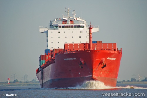
 Bomar Resolute
Current Status
Where is the vessel?
Bomar Resolute is currently in Near Valencia, based on AIS data received about 15h ago.
Latest AIS update:
Current position: 39.43838° N, 0.32876° W (Near Valencia)
Average speed (last 7 days): Loading…
Average speed (last 30 days): Loading…
Vessel profile: Bomar Resolute is a Container Ship with dimensions 232m x 32m.
This page combines live AIS, route history, probable destination signals, nearby traffic, and port activity for practical vessel monitoring.
The current position of vessel Bomar Resolute is 39.43838 lat / -0.32876 lng. Updated: 2026-05-20 07:29:24 UTCNearest reference points:
- Near Valencia
- Near Puebla de Farnals
- Near BURRIANA
Currently sailing under the flag of Liberia ![]()
Bomar Resolute built in 2007 year
Deadweight:
42074 tDetails:
Live Vessel Bomar Resolute Analytics (details, animations, etc.)
Recent AIS points (UTC):
2026-05-20 04:35:30 UTC · 39.43833, -0.32884 · SOG 0 kn · COG 203°2026-05-20 05:50:21 UTC · 39.43787, -0.32946 · SOG 0 kn · COG 203°
2026-05-20 07:23:25 UTC · 39.43834, -0.32888 · SOG 0 kn · COG 203°
2026-05-20 07:29:24 UTC · 39.43838, -0.32876 · SOG 0 kn · COG 203°