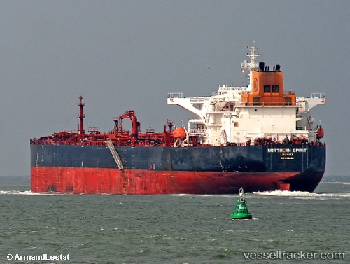
Kalahari
Current StatusWhere is the vessel?
Kalahari is currently in 15 nm E of Clallam Bay, based on AIS data received about 14h ago.
Latest AIS update:
Current position: 48.28641° N, 123.89315° W (15 nm E of Clallam Bay)
Average speed (last 7 days): Loading…
Average speed (last 30 days): Loading…
Vessel profile: Kalahari is a Crude Oil Tanker with dimensions 44m x 250m.
This page combines live AIS, route history, probable destination signals, nearby traffic, and port activity for practical vessel monitoring.
The current position of vessel Kalahari is 48.28641 lat / -123.89315 lng. Updated: 2026-05-19 23:39:46 UTCNearest reference points:
- Near Colwood
- Near Clallam Bay
- Near ESQUIMALT
Details:
Live Vessel Kalahari Analytics (details, animations, etc.)
Recent AIS points (UTC):
2026-05-19 19:43:55 UTC · 48.57687, -123.22666 · SOG 13.9 kn · COG 161°2026-05-19 21:56:27 UTC · 48.30044, -123.46993 · SOG 10.3 kn · COG 205°
2026-05-19 22:40:35 UTC · 48.26606, -123.63510 · SOG 11 kn · COG 270°
2026-05-19 23:39:46 UTC · 48.28641, -123.89315 · SOG 9.7 kn · COG 280°