 vesseltracker.com
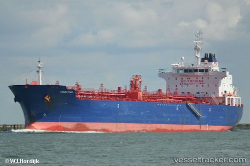
 Inviken
Current Status
Where is the vessel?
Inviken is currently in 17 nm SE of Kárpathos, based on AIS data received less than 1h ago.
Latest AIS update:
Current position: 35.33893° N, 27.50773° E (17 nm SE of Kárpathos)
Average speed (last 7 days): Loading…
Average speed (last 30 days): Loading…
Vessel profile: Inviken is a Chemical Oil Products Tanker with dimensions 184m x 27m.
This page combines live AIS, route history, probable destination signals, nearby traffic, and port activity for practical vessel monitoring.
The current position of vessel Inviken is 35.33893 lat / 27.50773 lng. Updated: 2026-04-29 06:07:29 UTCNearest reference points:
- Near PANORMITIS
- Near Kremasti
- Near Rhodes
Currently sailing under the flag of Liberia ![]()
Inviken built in 2009 year
Deadweight:
37873 tDetails:
Live Vessel Inviken Analytics (details, animations, etc.)
Recent AIS points (UTC):
2026-04-29 01:35:08 UTC · 35.34040, 27.56873 · SOG 0.5 kn · COG 28°2026-04-29 04:08:58 UTC · 35.34136, 27.53640 · SOG 0.5 kn · COG 42°
2026-04-29 04:35:38 UTC · 35.34078, 27.53042 · SOG 0.7 kn · COG 46°
2026-04-29 06:07:29 UTC · 35.33893, 27.50773 · SOG 0.8 kn · COG 40°