 CONGA
CONGA
Current Status
Where is the vessel?
CONGA is currently in Near KULEVI, based on AIS data received about 14h ago.
Latest AIS update:
Current position: 42.27405° N, 41.63998° E (Near KULEVI)
Average speed (last 7 days): Loading…
Average speed (last 30 days): Loading…
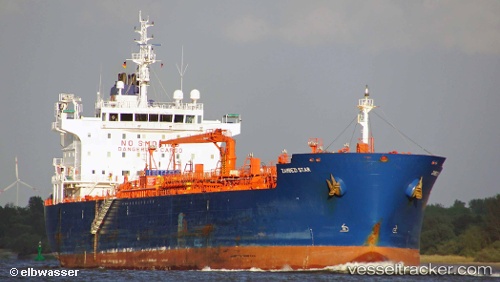
Vessel profile: CONGA is a Oil/Chemical Tanker with dimensions m x m.
This page combines live AIS, route history, probable destination signals, nearby traffic, and port activity for practical vessel monitoring.
The current position of vessel CONGA is 42.27405 lat / 41.63998 lng. Updated: 2026-06-16 11:52:41 UTCNearest reference points:
- Near KULEVI
- Near Poti
- Near Sup'sa
Currently sailing under the flag of Malta ![]()
Details:
Live Vessel CONGA Analytics (details, animations, etc.)
Recent AIS points (UTC):
2026-06-16 06:30:53 UTC · 42.27399, 41.64006 · SOG 0 kn · COG 286°2026-06-16 06:30:53 UTC · 42.27399, 41.64006 · SOG 0 kn · COG 286°
2026-06-16 06:30:53 UTC · 42.27399, 41.64006 · SOG 0 kn · COG 286°
2026-06-16 11:52:41 UTC · 42.27405, 41.63998 · SOG 0 kn · COG 286°