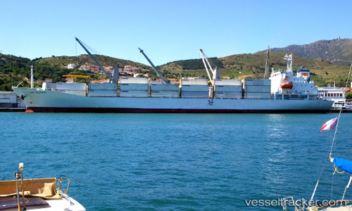
Lady Rosebud
Current StatusWhere is the vessel?
Lady Rosebud is currently in 42 nm N of Port Fitzroy, based on AIS data received about 14h ago.
Latest AIS update:
Current position: 35.49383° S, 175.59216° E (42 nm N of Port Fitzroy)
Average speed (last 7 days): Loading…
Average speed (last 30 days): Loading…
Vessel profile: Lady Rosebud is a Refrigerated Cargo Ship with dimensions 23m x 143m.
This page combines live AIS, route history, probable destination signals, nearby traffic, and port activity for practical vessel monitoring.
The current position of vessel Lady Rosebud is -35.49383 lat / 175.59216 lng. Updated: 2026-05-20 22:15:22 UTCNearest reference points:
- Near MARSDEN POINT
- 10 nm NE of Russel
- Near WHITIANGA
Details:
Live Vessel Lady Rosebud Analytics (details, animations, etc.)
Recent AIS points (UTC):
2026-05-20 16:02:48 UTC · -33.66833, 174.69267 · SOG 18.7 kn · COG 155°2026-05-20 18:06:33 UTC · -34.27083, 174.98582 · SOG 18.6 kn · COG 158°
2026-05-20 19:25:26 UTC · -34.65250, 175.17133 · SOG 18.8 kn · COG 156°
2026-05-20 22:15:22 UTC · -35.49383, 175.59216 · SOG 19.6 kn · COG 157°