 ST GEORGE
Current Status
Where is the vessel?
ST GEORGE is currently in 16 nm S of Palaiá Fókaia, based on AIS data received about 22h ago.
Latest AIS update:
Current position: 37.44749° N, 23.92921° E (16 nm S of Palaiá Fókaia)
Average speed (last 7 days): Loading…
Average speed (last 30 days): Loading…
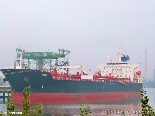
Vessel profile: ST GEORGE is a Chemical/Oil Products Tanker with dimensions 32m x 183m.
This page combines live AIS, route history, probable destination signals, nearby traffic, and port activity for practical vessel monitoring.
The current position of vessel ST GEORGE is 37.44749 lat / 23.92921 lng. Updated: 2026-07-09 07:39:02 UTCNearest reference points:
- Near Methana
- Near LAVRIO MARINA
- Near LAVRIO
Currently sailing under the flag of Liberia ![]()
ST GEORGE built in 2010 year
Deadweight:
50651 tDetails:
Live Vessel ST GEORGE Analytics (details, animations, etc.)
Recent AIS points (UTC):
2026-07-09 05:09:02 UTC · 37.44729, 23.93230 · SOG 0.2 kn · COG 348°2026-07-09 06:36:02 UTC · 37.44701, 23.93037 · SOG 0.2 kn · COG 3°
2026-07-09 07:24:02 UTC · 37.44759, 23.92919 · SOG 0.1 kn · COG 39°
2026-07-09 07:39:02 UTC · 37.44749, 23.92921 · SOG 0 kn · COG 40°