 AL HARTHY TIDE
Current Status
Where is the vessel?
AL HARTHY TIDE is currently in Near Futila Terminal, based on AIS data received about 1228d ago.
Latest AIS update:
Current position: 5.33045° S, 12.12017° E (Near Futila Terminal)
Average speed (last 7 days): Loading…
Average speed (last 30 days): Loading…
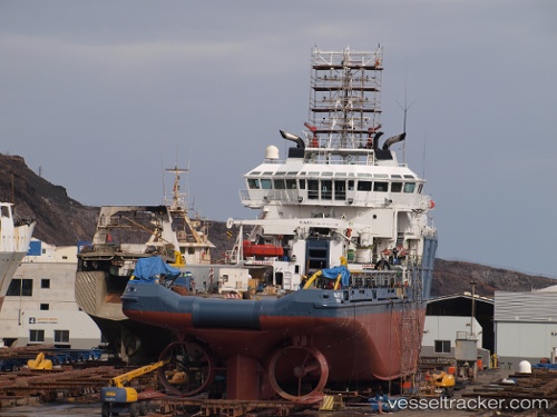
Vessel profile: AL HARTHY TIDE is a Offshore Tug/Supply Ship with dimensions 16m x 73m.
This page combines live AIS, route history, probable destination signals, nearby traffic, and port activity for practical vessel monitoring.
The current position of vessel AL HARTHY TIDE is -5.33045 lat / 12.12017 lng. Updated: 2023-01-10 18:36:46 UTCNearest reference points:
- Near Futila Terminal
- 11 nm W of Cabinda
- Near N'Kossa Terminal
Currently sailing under the flag of Vanuatu ![]()
AL HARTHY TIDE built in 2009 year
Deadweight:
2551 tDetails:
Live Vessel AL HARTHY TIDE Analytics (details, animations, etc.)
Recent AIS points (UTC):
2023-01-10 18:36:46 UTC · -5.33045, 12.12017 · SOG 0 kn · COG 165°