 Normand Ranger
Current Status
Where is the vessel?
Normand Ranger is currently in 114 nm N of Melville Island, based on AIS data received about 15h ago.
Latest AIS update:
Current position: 9.77988° S, 130.22047° E (114 nm N of Melville Island)
Average speed (last 7 days): Loading…
Average speed (last 30 days): Loading…
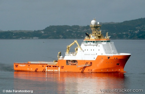
Vessel profile: Normand Ranger is a Offshore Tug Supply Ship with dimensions 91m x 22m.
This page combines live AIS, route history, probable destination signals, nearby traffic, and port activity for practical vessel monitoring.
The current position of vessel Normand Ranger is -9.77988 lat / 130.22047 lng. Updated: 2026-06-26 19:41:45 UTCCurrently sailing under the flag of Norway ![]()
Normand Ranger built in 2010 year
Deadweight:
4559 tDetails:
Live Vessel Normand Ranger Analytics (details, animations, etc.)
Recent AIS points (UTC):
2026-06-26 16:14:14 UTC · -9.78532, 130.21201 · SOG 2.7 kn · COG -1°2026-06-26 18:08:35 UTC · -9.77667, 130.18832 · SOG 1 kn · COG -1°
2026-06-26 19:29:34 UTC · -9.77833, 130.21500 · SOG 1 kn · COG -1°
2026-06-26 19:41:45 UTC · -9.77988, 130.22047 · SOG 1.3 kn · COG 100°