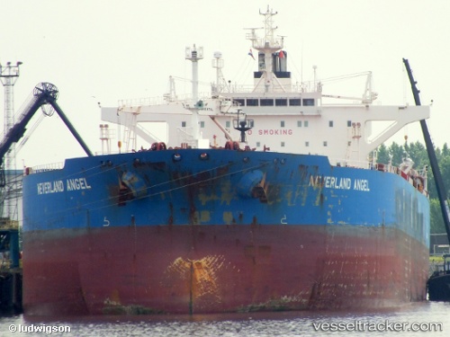
 Elandra Angel
Current Status
Where is the vessel?
Elandra Angel is currently in 49 nm E of Longyan Pt, based on AIS data received about 14h ago.
Latest AIS update:
Current position: 37.64379° N, 123.63396° E (49 nm E of Longyan Pt)
Average speed (last 7 days): Loading…
Average speed (last 30 days): Loading…
Vessel profile: Elandra Angel is a Crude Oil Tanker with dimensions 249m x 44m.
This page combines live AIS, route history, probable destination signals, nearby traffic, and port activity for practical vessel monitoring.
The current position of vessel Elandra Angel is 37.64379 lat / 123.63396 lng. Updated: 2026-05-22 08:03:42 UTCNearest reference points:
- 54 nm E of Longyan Pt
- 34 nm E of Longyan Pt
- 54 nm W of Yonggipo
Currently sailing under the flag of Liberia ![]()
Elandra Angel built in 2009 year
Deadweight:
115949 tDetails:
Live Vessel Elandra Angel Analytics (details, animations, etc.)
Recent AIS points (UTC):
2026-05-22 02:38:36 UTC · 37.65005, 123.63031 · SOG 0 kn · COG 161°2026-05-22 02:38:36 UTC · 37.65005, 123.63031 · SOG 0 kn · COG 161°
2026-05-22 08:03:42 UTC · 37.64379, 123.63396 · SOG 0 kn · COG -1°
2026-05-22 08:03:42 UTC · 37.64379, 123.63396 · SOG 0 kn · COG -1°