 Rapallo
Current Status
Where is the vessel?
Rapallo is currently in 170 nm S of Tsiombe, based on AIS data received about 15h ago.
Latest AIS update:
Current position: 28.05333° S, 46.19833° E (170 nm S of Tsiombe)
Average speed (last 7 days): Loading…
Average speed (last 30 days): Loading…
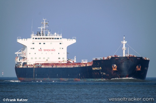
Vessel profile: Rapallo is a Bulk Carrier with dimensions 225m x 32m.
This page combines live AIS, route history, probable destination signals, nearby traffic, and port activity for practical vessel monitoring.
The current position of vessel Rapallo is -28.05333 lat / 46.19833 lng. Updated: 2026-05-20 10:22:45 UTCNearest reference points:
- 174 nm S of Ambovombe
- 106 nm S of Tsiombe
- 70 nm SW of Tsiombe
Currently sailing under the flag of Malta ![]()
Rapallo built in 2009 year
Deadweight:
75123 tDetails:
Live Vessel Rapallo Analytics (details, animations, etc.)
Recent AIS points (UTC):
2026-05-20 07:42:39 UTC · -28.30314, 45.67955 · SOG 11.8 kn · COG 59°2026-05-20 08:01:19 UTC · -28.27331, 45.73988 · SOG 11.8 kn · COG 60°
2026-05-20 09:24:03 UTC · -28.14749, 46.01234 · SOG 11.4 kn · COG 62°
2026-05-20 10:22:45 UTC · -28.05333, 46.19833 · SOG 11 kn · COG -1°