 GLEN COVE
Current Status
Where is the vessel?
GLEN COVE is currently in 48 nm SW of Togiak, based on AIS data received about 15h ago.
Latest AIS update:
Current position: 58.53589° N, 161.56035° W (48 nm SW of Togiak)
Average speed (last 7 days): Loading…
Average speed (last 30 days): Loading…
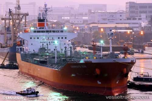
Vessel profile: GLEN COVE is a Chemical/Oil Products Tanker with dimensions 27m x 159m.
This page combines live AIS, route history, probable destination signals, nearby traffic, and port activity for practical vessel monitoring.
The current position of vessel GLEN COVE is 58.53589 lat / -161.56035 lng. Updated: 2026-05-20 04:16:14 UTCCurrently sailing under the flag of Marshall Islands ![]()
GLEN COVE built in 2008 year
Deadweight:
25615 tDetails:
Live Vessel GLEN COVE Analytics (details, animations, etc.)
Recent AIS points (UTC):
2026-05-20 00:58:14 UTC · 58.53807, -161.55772 · SOG 0.1 kn · COG 163°2026-05-20 01:16:15 UTC · 58.53818, -161.55887 · SOG 0 kn · COG 143°
2026-05-20 03:37:15 UTC · 58.53588, -161.56042 · SOG 0 kn · COG 83°
2026-05-20 04:16:14 UTC · 58.53589, -161.56035 · SOG 0 kn · COG 85°