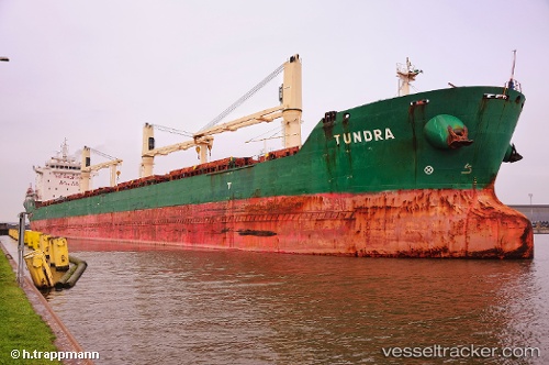
Tundra
Current StatusWhere is the vessel?
Tundra is currently in 50 nm S of White Rose Field, based on AIS data received about 14h ago.
Latest AIS update:
Current position: 45.99417° N, 47.60777° W (50 nm S of White Rose Field)
Average speed (last 7 days): Loading…
Average speed (last 30 days): Loading…
Vessel profile: Tundra is a Bulk Carrier with dimensions 23m x 185m.
This page combines live AIS, route history, probable destination signals, nearby traffic, and port activity for practical vessel monitoring.
The current position of vessel Tundra is 45.99417 lat / -47.60777 lng. Updated: 2026-05-20 12:01:02 UTCNearest reference points:
- 24 nm SW of White Rose Field
- 165 nm S of White Rose Field
Details:
Live Vessel Tundra Analytics (details, animations, etc.)
Recent AIS points (UTC):
2026-05-20 07:57:39 UTC · 45.99667, -48.71667 · SOG 11 kn · COG -1°2026-05-20 09:21:43 UTC · 45.99891, -48.32903 · SOG 11.6 kn · COG 86°
2026-05-20 11:05:52 UTC · 45.99299, -47.85429 · SOG 11.2 kn · COG 83°
2026-05-20 12:01:02 UTC · 45.99417, -47.60777 · SOG 11.3 kn · COG 84°