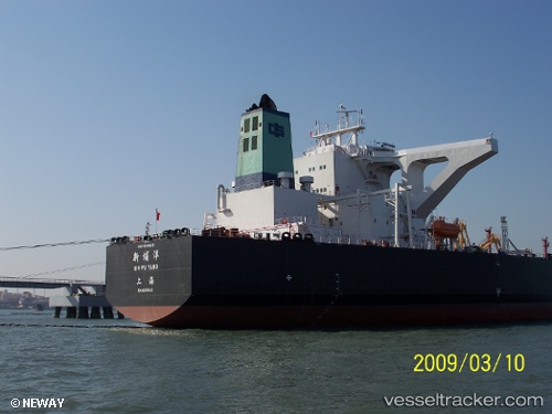
Xin Pu Yang
Current StatusWhere is the vessel?
Xin Pu Yang is currently in 261 nm SW of LHOKNGA, based on AIS data received about 14h ago.
Latest AIS update:
Current position: 3.68652° N, 91.25329° E (261 nm SW of LHOKNGA)
Average speed (last 7 days): Loading…
Average speed (last 30 days): Loading…
Vessel profile: Xin Pu Yang is a Crude Oil Tanker with dimensions 60m x 333m.
This page combines live AIS, route history, probable destination signals, nearby traffic, and port activity for practical vessel monitoring.
The current position of vessel Xin Pu Yang is 3.68652 lat / 91.25329 lng. Updated: 2026-06-27 02:16:11 UTCNearest reference points:
- 172 nm W of LHOKNGA
- 243 nm E of Abakaliki
Details:
Live Vessel Xin Pu Yang Analytics (details, animations, etc.)
Recent AIS points (UTC):
2026-06-26 22:46:09 UTC · 4.16825, 91.90732 · SOG 13.8 kn · COG 242°2026-06-27 00:18:03 UTC · 3.96502, 91.61828 · SOG 14.1 kn · COG 229°
2026-06-27 01:51:12 UTC · 3.74300, 91.33059 · SOG 13.8 kn · COG 234°
2026-06-27 02:16:11 UTC · 3.68652, 91.25329 · SOG 14 kn · COG 233°