 vesseltracker.com
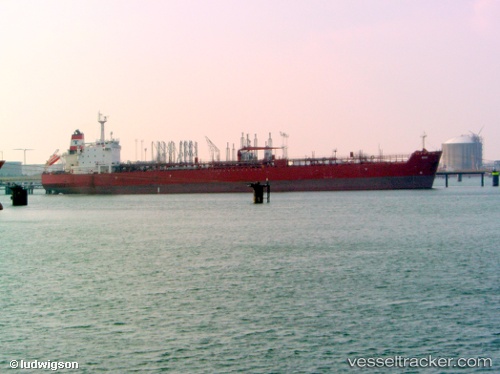
 Ohio
Ohio
Current Status
Where is the vessel?
Ohio is currently in 27 nm NE of Es Sider, based on AIS data received less than 1h ago.
Latest AIS update:
Current position: 31.00990° N, 18.64932° E (27 nm NE of Es Sider)
Average speed (last 7 days): Loading…
Average speed (last 30 days): Loading…
Vessel profile: Ohio is a Crude Oil Tanker with dimensions 244m x 42m.
This page combines live AIS, route history, probable destination signals, nearby traffic, and port activity for practical vessel monitoring.
The current position of vessel Ohio is 31.00990 lat / 18.64932 lng. Updated: 2026-05-17 20:10:04 UTCNearest reference points:
- Near BENGHAZI
- Near Banghazi
- 60 nm S of Pinelands
Currently sailing under the flag of Bahamas ![]()
Ohio built in 2009 year
Deadweight:
105188 tDetails:
Live Vessel Ohio Analytics (details, animations, etc.)
Recent AIS points (UTC):
2026-05-17 16:04:24 UTC · 30.52656, 18.59620 · SOG 2.7 kn · COG 320°2026-05-17 16:04:24 UTC · 30.52656, 18.59620 · SOG 2.7 kn · COG 320°
2026-05-17 19:30:35 UTC · 30.88712, 18.64967 · SOG 11.3 kn · COG 2°
2026-05-17 20:10:04 UTC · 31.00990, 18.64932 · SOG 11 kn · COG 4°