 ANIKA
ANIKA
Current Status
Where is the vessel?
ANIKA is currently in 26 nm W of Hirtshals, based on AIS data received about 13d ago.
Latest AIS update:
Current position: 57.73388° N, 9.19313° E (26 nm W of Hirtshals)
Average speed (last 7 days): Loading…
Average speed (last 30 days): Loading…
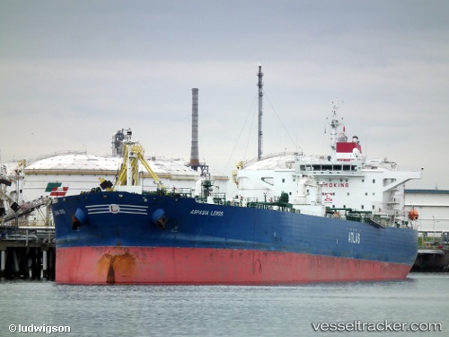
Vessel profile: ANIKA is a Crude Oil Tanker with dimensions m x m.
This page combines live AIS, route history, probable destination signals, nearby traffic, and port activity for practical vessel monitoring.
The current position of vessel ANIKA is 57.73388 lat / 9.19313 lng. Updated: 2026-05-06 12:40:51 UTCNearest reference points:
- 28 nm NW of Lokken
- 27 nm N of HANSTHOLM
- Near Hirtshals
Currently sailing under the flag of Panama ![]()
Details:
Live Vessel ANIKA Analytics (details, animations, etc.)
Recent AIS points (UTC):
2026-05-06 12:40:51 UTC · 57.73388, 9.19313 · SOG 19.5 kn · COG 76°2026-05-06 12:40:51 UTC · 57.73388, 9.19313 · SOG 19.5 kn · COG 76°
2026-05-06 12:40:51 UTC · 57.73388, 9.19313 · SOG 19.5 kn · COG 76°
2026-05-06 12:40:51 UTC · 57.73388, 9.19313 · SOG 19.5 kn · COG 76°
2026-05-06 12:40:51 UTC · 57.73388, 9.19313 · SOG 19.5 kn · COG 76°