 SUPER G
Current Status
Where is the vessel?
SUPER G is currently in 95 nm E of Natal, based on AIS data received about 15h ago.
Latest AIS update:
Current position: 5.44221° S, 33.61714° W (95 nm E of Natal)
Average speed (last 7 days): Loading…
Average speed (last 30 days): Loading…
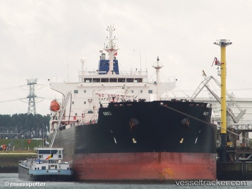
Vessel profile: SUPER G is a Chemical Oil Products Tanker with dimensions 183m x 32m.
This page combines live AIS, route history, probable destination signals, nearby traffic, and port activity for practical vessel monitoring.
The current position of vessel SUPER G is -5.44221 lat / -33.61714 lng. Updated: 2026-05-22 11:28:12 UTCNearest reference points:
- 20 nm E of Natal
Currently sailing under the flag of Liberia ![]()
SUPER G built in 2010 year
Deadweight:
50747 tDetails:
Live Vessel SUPER G Analytics (details, animations, etc.)
Recent AIS points (UTC):
2026-05-22 08:06:40 UTC · -6.14403, -33.85651 · SOG 13.1 kn · COG 20°2026-05-22 09:54:43 UTC · -5.76841, -33.72835 · SOG 13.2 kn · COG 20°
2026-05-22 11:05:53 UTC · -5.52088, -33.64411 · SOG 13.2 kn · COG 20°
2026-05-22 11:28:12 UTC · -5.44221, -33.61714 · SOG 13.2 kn · COG 22°